Read the draft
You can learn more about the proposed edits to the land use code in a couple of ways:
- You can view a clean version of the final draft.
- Or if you’re interested in what’s changed since the last round of edits, you can explore redlines to Articles 1-7 and redlines to Articles 8-19.
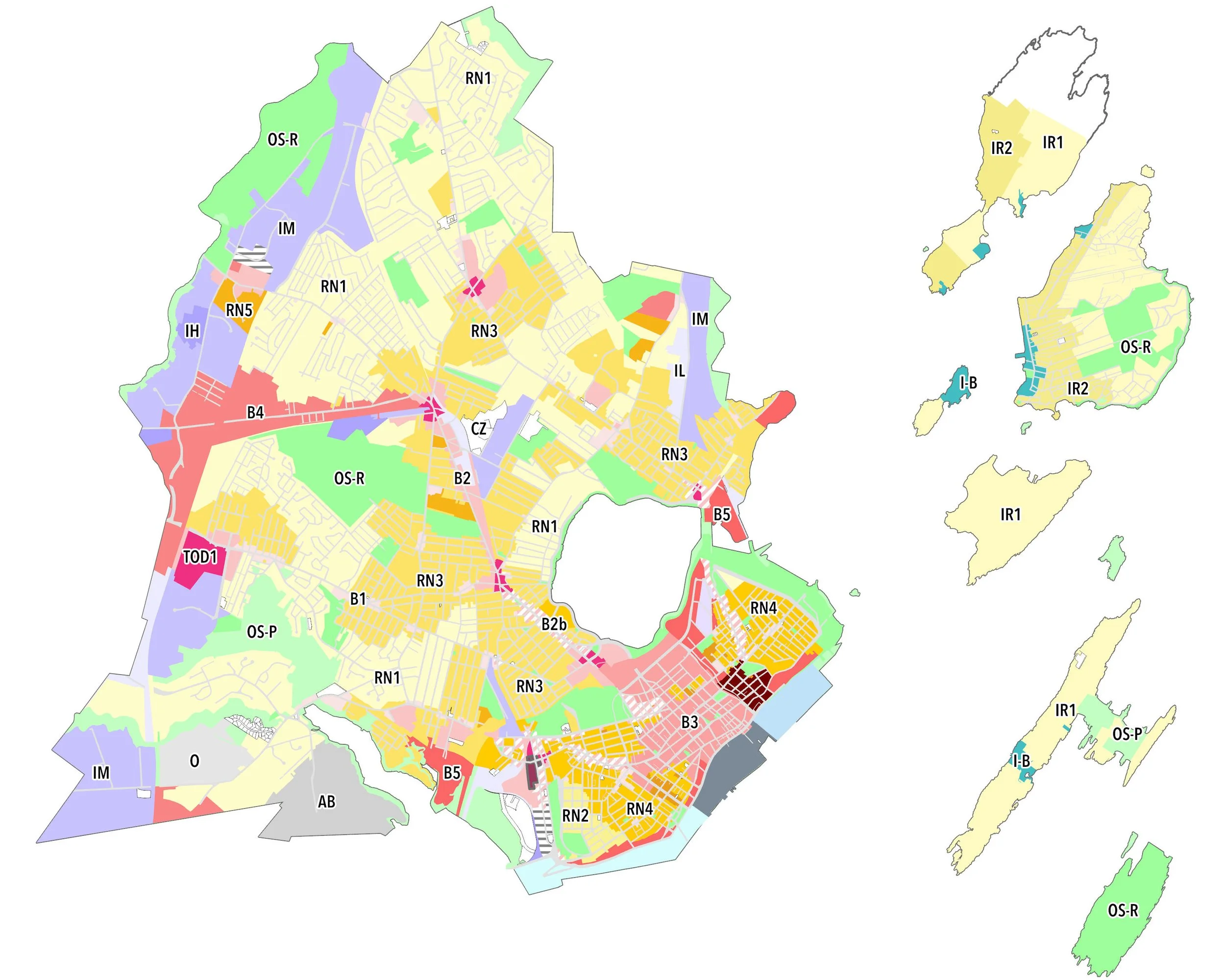
Explore the draft zoning map
Take a look at the final draft zoning map here.
Final draft changes
to the land use code + zoning map
The release of the final draft land use code and zoning map signals the culmination of a momentous City-wide effort to modernize our century-old zoning code to meet the needs of today’s Portland. The final draft changes respond to almost 900 individual comments received over the course of the spring and summer at the two-day ReCode Studio, through our online map and code comment platforms, and via emails, meetings, and phone calls. They also respond to feedback from two Planning Board workshops and two workshops of the Historic Preservation Board.
WHAT HAS CHANGED SINCE THE SECOND WAVE?
The final draft changes consolidate additional zoning districts (the proposed RN-1 and RN-2), add new Transit-Oriented Development and mixed-use zones to the zoning map, refine dimensional standards to support growth at key intersections and along key corridors (as shown in Portland’s Plan), add permitted uses to certain zones to provide more flexibility, and revise zone boundaries where appropriate. It’s important to note - the residential zoning structure continues to look different, with all of the mainland residential zones having new names. In the final draft, the proposed RN-1 and RN-2 have been consolidated, so the conversions now look like this:
For a quick summary of what’s proposed in the final drafts for our base residential and mixed-use zones, view an updated version of our zone guides here.
WHAT’s NEXT?
The next steps are a Planning Board workshop on September 17, followed by a hearing on October 8 (note that this is a new date!). The City Council will hold their first workshop on ReCode on September 30. So now is the time to provide any final comments on ReCode! We appreciate all of the feedback we’ve received to date, and we will continue to welcome comments as the Planning Board and City Council process progress.
RECODE: MYTH V. FACT
Have you pondered the future of single-family neighborhoods in Portland, been concerned about off-street parking requirements, or feel TOD zones are mapped in limited areas? Check out our compiled resource on common Myth v. Fact questions pertaining to ReCode by clicking on the gull!


